![](/images/other/stat-length.png)
![Percorso A piedi Eggendorf im Traunkreis - Naturlehrpfad - Photo](https://media.geolcdn.com/t/1900/400/87531291-6995-40ce-8046-4153ddbec4a9.jpeg&format=pjpeg&maxdim=2)
Naturlehrpfad
SityTrail - itinéraires balisés pédestres
Tous les sentiers balisés d’Europe GUIDE+
![Lunghezza](/images/other/stat-length.png)
Lunghezza
5 km
![Altitudine massima](https://static1.geolcdn.com/siteimages/upload/files/1508320355ic_sort_altitude_max_24dp.png)
Altitudine massima
381 m
![Dislivello positivo](https://static1.geolcdn.com/siteimages/upload/files/1508320355ic_sort_den_pos_24dp.png)
Dislivello positivo
56 m
![Km-Effort](/images/other/stat-length.png)
Km-Effort
5,7 km
![Altitudine minima](https://static1.geolcdn.com/siteimages/upload/files/1508320355ic_sort_altitude_min_24dp.png)
Altitudine minima
337 m
![Dislivello negativo](https://static1.geolcdn.com/siteimages/upload/files/1508320355ic_sort_den_neg_24dp.png)
Dislivello negativo
46 m
![Boucle](https://static1.geolcdn.com/siteimages/upload/files/16400158638029165_repeat_loop_refresh_sync_direction_icon.png)
Boucle
Sì
Tag
Data di creazione :
2022-02-16 16:48:25.6
Ultima modifica :
2022-03-03 12:18:13.965
![A piedi](https://static1.geolcdn.com/sitytour/trail-icons/100.png)
1h17
Difficoltà : Facile
![Scannerizza questo codice QR per aprire il percorso nell'applicazione SityTrail](https://capi.geolives.com/qq0zvz2zws4bq2lad0pu/sitytour/trails/3127935/qr.png?size=200)
Applicazione GPS da escursionismo GRATUITA
Chi siamo
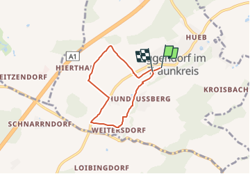
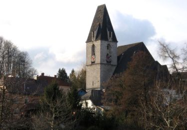
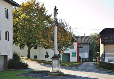
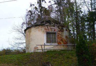
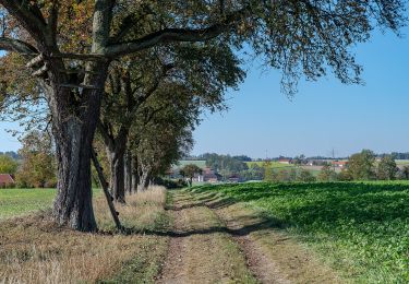
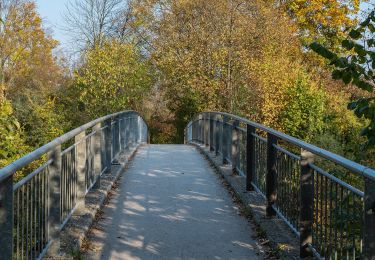
Percorso A piedi di 5 km da scoprire a Oberösterreich, Bezirk Linz-Land, Eggendorf im Traunkreis. Questo percorso è proposto da SityTrail - itinéraires balisés pédestres.
Descrizione
Trail created by Gemeinde Eggendorf im Traunkreis.
Symbol: gelber Hinweispfeil mit schwarzem Text "Naturlehrpfad"
Localizzazione
Paese:
Austria
Regione :
Oberösterreich
Dipartimento/Provincia :
Bezirk Linz-Land
Comune :
Eggendorf im Traunkreis
Località :
Unknown
Partenza:(Dec)
Partenza:(UTM)
436405 ; 5331110 (33U) N.
Commenti
Percorsi nelle vicinanze
![Percorso A piedi Schleißheim - AVE-Runde - Photo](https://media.geolcdn.com/t/375/260/df608299-9ed7-4e06-a771-adea75140764.jpeg&format=jpg&maxdim=2)
![A piedi A piedi](https://static1.geolcdn.com/sitytour/trail-icons/100.png)
AVE-Runde
A piedi
Facile
Schleißheim,
Oberösterreich,
Bezirk Wels-Land,
Austria
![](/images/other/stat-length.png)
7,7 km | 9,3 km-effort
2h 7min
![](https://static1.geolcdn.com/siteimages/upload/files/16400158638029165_repeat_loop_refresh_sync_direction_icon.png)
Sì
![Percorso A piedi Kematen an der Krems - Bauernroas - Photo](https://media.geolcdn.com/t/375/260/45c5642e-3917-47fa-9fa8-eb57cf0c39b1.jpeg&format=jpg&maxdim=2)
![A piedi A piedi](https://static1.geolcdn.com/sitytour/trail-icons/100.png)
Bauernroas
A piedi
Facile
Kematen an der Krems,
Oberösterreich,
Bezirk Linz-Land,
Austria
![](/images/other/stat-length.png)
9 km | 10,7 km-effort
2h 26min
![](https://static1.geolcdn.com/siteimages/upload/files/16400158638029165_repeat_loop_refresh_sync_direction_icon.png)
Sì
![Percorso A piedi Eggendorf im Traunkreis - 4 Gemeinden Wanderweg - Photo](https://media.geolcdn.com/t/375/260/d417daf7-3054-41dc-a94b-b9b4bcee44b6.jpeg&format=jpg&maxdim=2)
![A piedi A piedi](https://static1.geolcdn.com/sitytour/trail-icons/100.png)
4 Gemeinden Wanderweg
A piedi
Facile
Eggendorf im Traunkreis,
Oberösterreich,
Bezirk Linz-Land,
Austria
![](/images/other/stat-length.png)
12,3 km | 14,7 km-effort
3h 20min
![](https://static1.geolcdn.com/siteimages/upload/files/16400158638029165_repeat_loop_refresh_sync_direction_icon.png)
Sì
![Percorso A piedi Piberbach - Wanderweg Winden - Photo](https://media.geolcdn.com/t/375/260/0f416557-2011-4ccc-801f-210434ae409f.jpeg&format=jpg&maxdim=2)
![A piedi A piedi](https://static1.geolcdn.com/sitytour/trail-icons/100.png)
Wanderweg Winden
A piedi
Facile
Piberbach,
Oberösterreich,
Bezirk Linz-Land,
Austria
![](/images/other/stat-length.png)
8,3 km | 9,5 km-effort
2h 9min
![](https://static1.geolcdn.com/siteimages/upload/files/16400158638029165_repeat_loop_refresh_sync_direction_icon.png)
Sì
![Percorso A piedi Allhaming - Rundwanderweg Allhaminger Forst - Photo](https://media.geolcdn.com/t/375/260/df9e76b1-de45-46b2-846a-fbd648a7152b.jpeg&format=jpg&maxdim=2)
![A piedi A piedi](https://static1.geolcdn.com/sitytour/trail-icons/100.png)
Rundwanderweg Allhaminger Forst
A piedi
Facile
Allhaming,
Oberösterreich,
Bezirk Linz-Land,
Austria
![](/images/other/stat-length.png)
9,8 km | 12,3 km-effort
2h 47min
![](https://static1.geolcdn.com/siteimages/upload/files/16400158638029165_repeat_loop_refresh_sync_direction_icon.png)
Sì
![Percorso A piedi Allhaming - Rundwanderweg Lindach - Photo](https://media.geolcdn.com/t/375/260/739d009a-1779-4fe5-8ca5-b48cd6b89e47.jpeg&format=jpg&maxdim=2)
![A piedi A piedi](https://static1.geolcdn.com/sitytour/trail-icons/100.png)
Rundwanderweg Lindach
A piedi
Facile
Allhaming,
Oberösterreich,
Bezirk Linz-Land,
Austria
![](/images/other/stat-length.png)
13,8 km | 17,3 km-effort
3h 55min
![](https://static1.geolcdn.com/siteimages/upload/files/16400158638029165_repeat_loop_refresh_sync_direction_icon.png)
Sì
![Percorso A piedi Allhaming - Rundwanderweg Sipbach - Photo](https://media.geolcdn.com/t/375/260/5dde0db1-1caf-4bac-8afd-e56be27f152b.jpeg&format=jpg&maxdim=2)
![A piedi A piedi](https://static1.geolcdn.com/sitytour/trail-icons/100.png)
Rundwanderweg Sipbach
A piedi
Facile
Allhaming,
Oberösterreich,
Bezirk Linz-Land,
Austria
![](/images/other/stat-length.png)
12,3 km | 14,7 km-effort
3h 20min
![](https://static1.geolcdn.com/siteimages/upload/files/16400158638029165_repeat_loop_refresh_sync_direction_icon.png)
No
![Percorso A piedi Allhaming - Rundwanderweg Laimgräben - Photo](https://media.geolcdn.com/t/375/260/f761b576-3b1c-4d6e-9331-0d3f2a0bde5d.jpeg&format=jpg&maxdim=2)
![A piedi A piedi](https://static1.geolcdn.com/sitytour/trail-icons/100.png)
Rundwanderweg Laimgräben
A piedi
Facile
Allhaming,
Oberösterreich,
Bezirk Linz-Land,
Austria
![](/images/other/stat-length.png)
11,6 km | 14,4 km-effort
3h 16min
![](https://static1.geolcdn.com/siteimages/upload/files/16400158638029165_repeat_loop_refresh_sync_direction_icon.png)
Sì
![Percorso A piedi Kematen an der Krems - Tassiloweg - Photo](https://media.geolcdn.com/t/375/260/537a350d-7e76-434c-abba-392c1d968e40.jpeg&format=jpg&maxdim=2)
![A piedi A piedi](https://static1.geolcdn.com/sitytour/trail-icons/100.png)
Tassiloweg
A piedi
Facile
Kematen an der Krems,
Oberösterreich,
Bezirk Linz-Land,
Austria
![](/images/other/stat-length.png)
4,7 km | 5 km-effort
1h 8min
![](https://static1.geolcdn.com/siteimages/upload/files/16400158638029165_repeat_loop_refresh_sync_direction_icon.png)
No